







هذا التقرير متاح أيضًا بـ العربية
The Israeli occupation army informed the ministerial mini-cabinet, on July 15, 2026, that it had taken control of between 67 and 70% of the Gaza Strip’s area after expanding its deployment beyond the “yellow line,” which was supposed to confine its presence to about 53% of the enclave.
That was later confirmed by statements from Israeli occupation army minister Israel Katz, who said, “Soon we will have destroyed 70% of the Gaza Strip’s area, above ground and below it,” as well as Israeli Energy Minister Eli Cohen , who said, “We control nearly 70% of the Gaza Strip’s area, and we will control it entirely within weeks.”
As the occupation machine swallows up new areas in the eastern part of the enclave, and its officials openly and explicitly boast of destroying entire neighborhoods and erasing their features, satellite images, field photographs, and exclusive testimonies collected by Noon Post reveal hundreds of thousands of displaced people crammed onto the coastal strip.
This belt took shape through successive waves of displacement, as military operations, evacuation orders, and the clearing out of displacement sites forced tens of thousands of families to pick themselves up and head toward a narrow patch on the enclave’s western coast, stretching from al-Mawasi in Khan Younis in the south, through Deir al-Balah, to Gaza Port west of Gaza City.
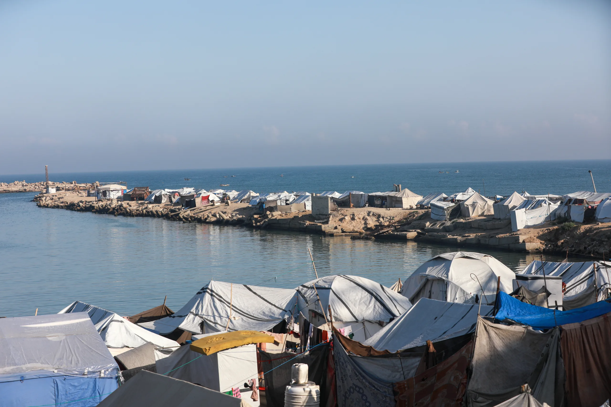
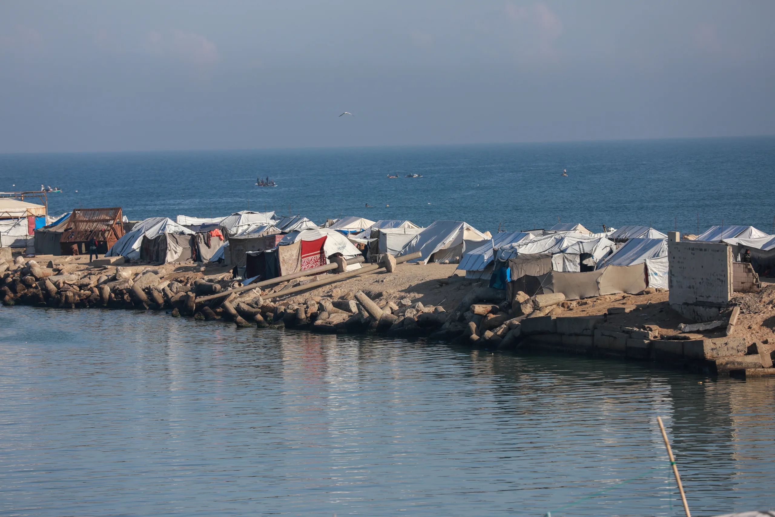
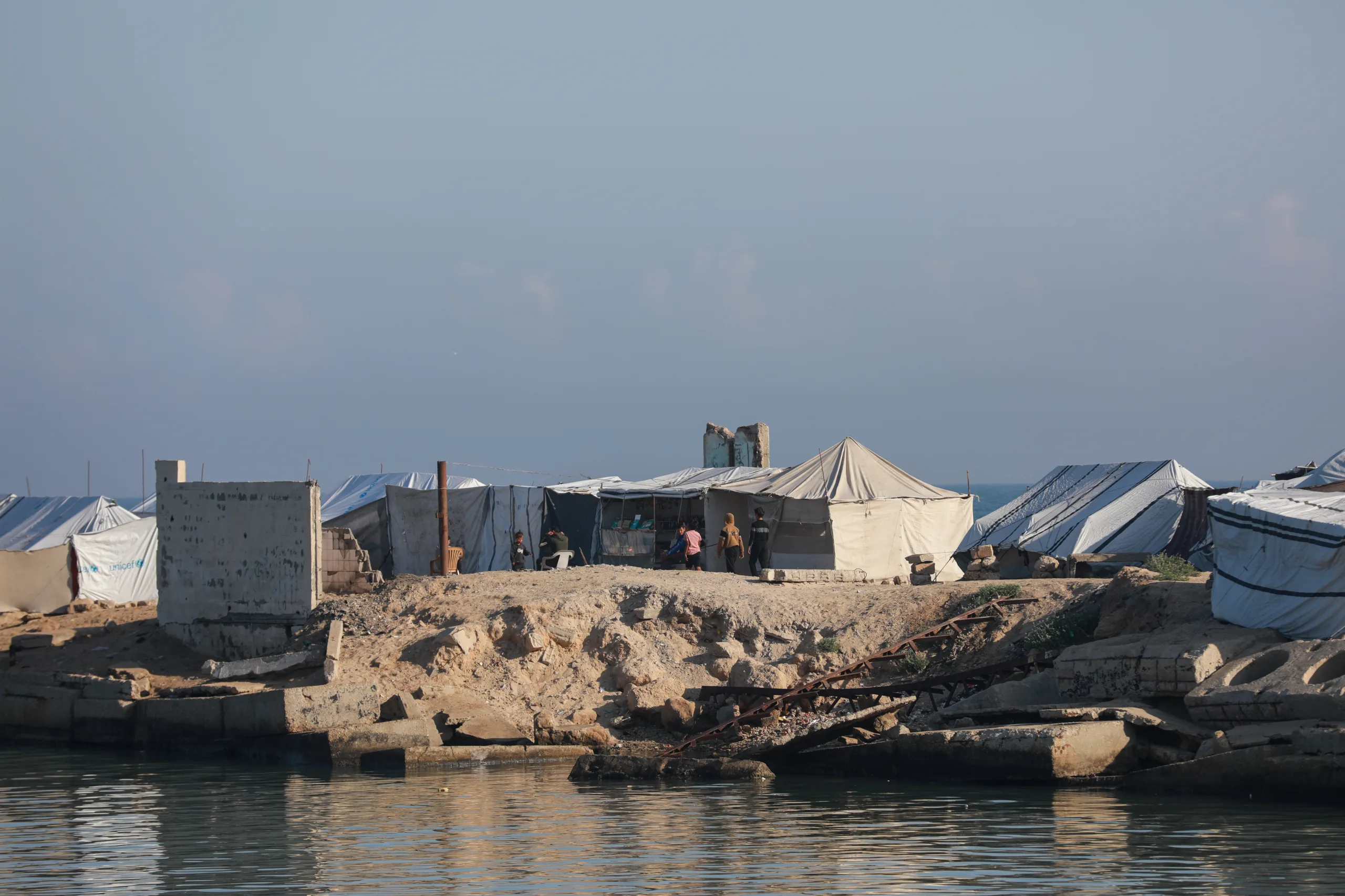
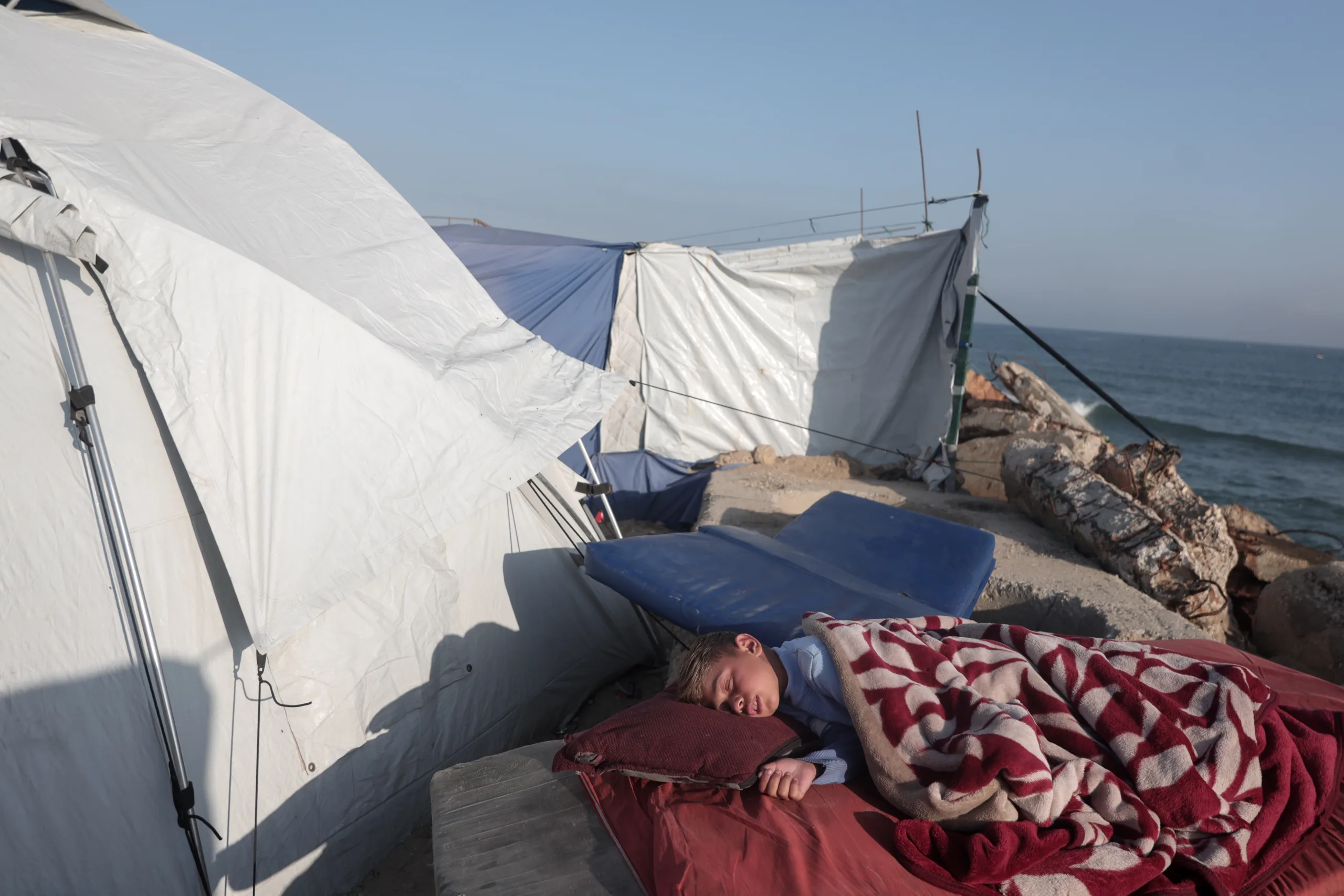
In some locations, only a few meters separate the tents from the sea, while in others, only piles of rocks and rubble or a narrow strip of sand stand between the tents and the waves.
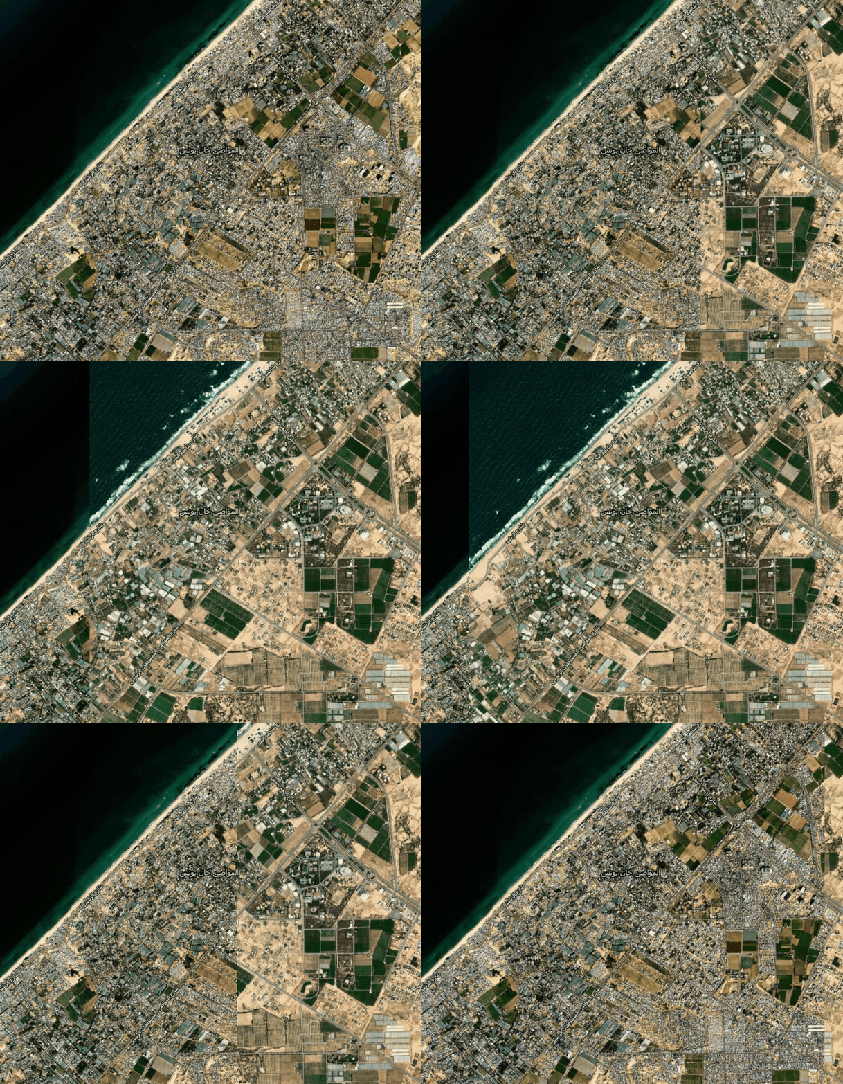
The space for survival between the yellow line and the sea’s edge
The narrowing of the space available to Palestinians began with the ceasefire agreement in October 2025, when the “yellow line” marked the Israeli occupation army’s initial deployment point, leaving about 53% of the enclave under its control, while 47% remained where most of the population was concentrated west of the line.
But the yellow concrete markers later moved westward at various points, in tandem with new incursions and the establishment of berms and military positions, pushing additional neighborhoods and areas out of the zone for habitation and movement and depriving residents of returning to their homes and land.
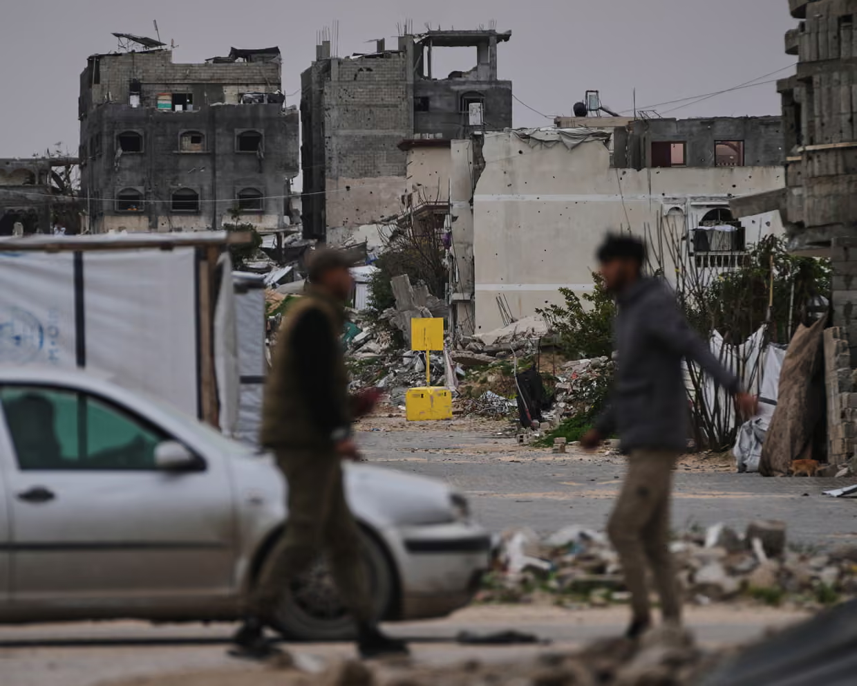
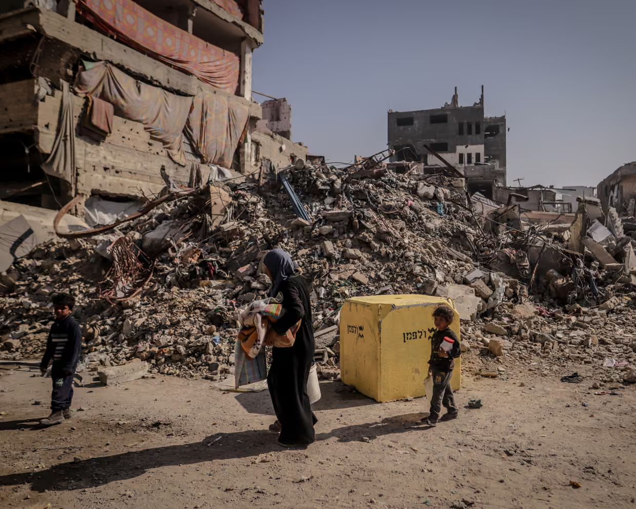
Yellow concrete blocks mark the route of the “yellow line” inside the Gaza Strip. Source: The Associated Press and Anadolu.
In March 2026, the army expanded the scope of restrictions through maps it sent to relief organizations, which included what became known as the “orange line,” extending west of the “yellow line” into the area where Palestinians live.
As the scope of restrictions continued to expand, the United Nations said on June 26, 2026, that restricted-access areas now covered about 65% of the Gaza Strip, most of them off-limits to residents.
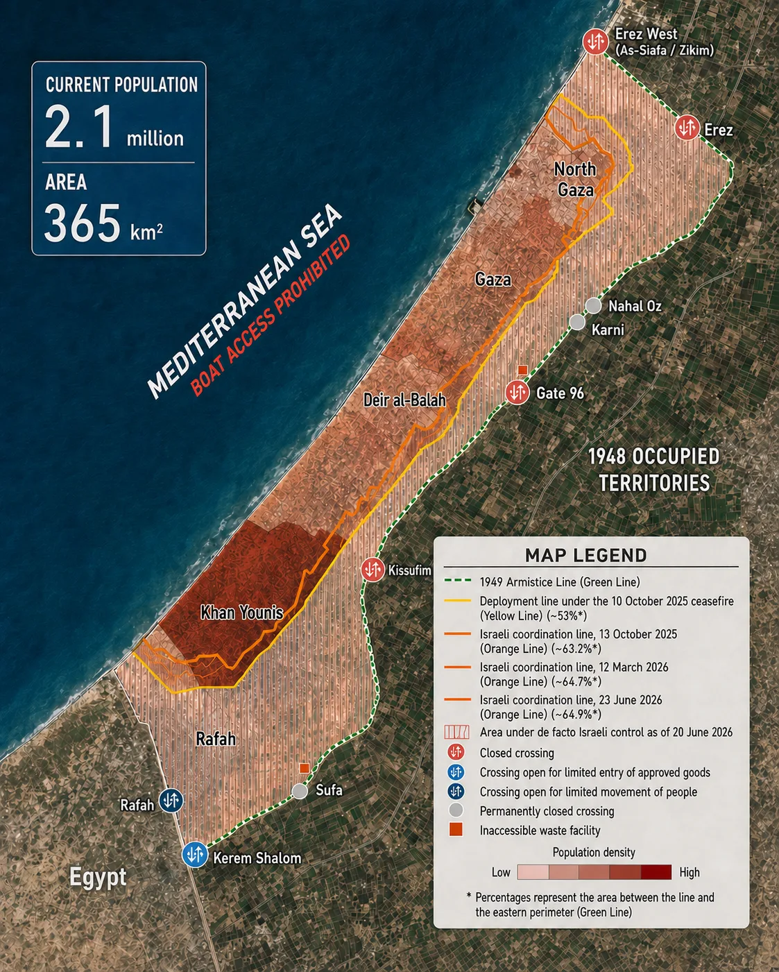
As military control zones expanded eastward, the space available to Palestinians shrank further because of the destruction. According to the latest comprehensive assessment published by the United Nations satellite center UNOSAT , about 81% of Gaza’s structures had been damaged as of Oct. 11, 2025, including nearly 320,000 housing units.
The war also left behind more than 61 million tons of rubble, covering neighborhoods, blocking roads, and obstructing access to land and services, according to estimates issued by the United Nations Development Program in July 2026.
To the last meter of dry land…
According to the United Nations , 90% of Gaza’s population, about 2.1 million people, fled their homes during the war. With borders nearly sealed, return impossible, and shelters and inland areas full, successive waves of displacement moved toward the open spaces in the west.
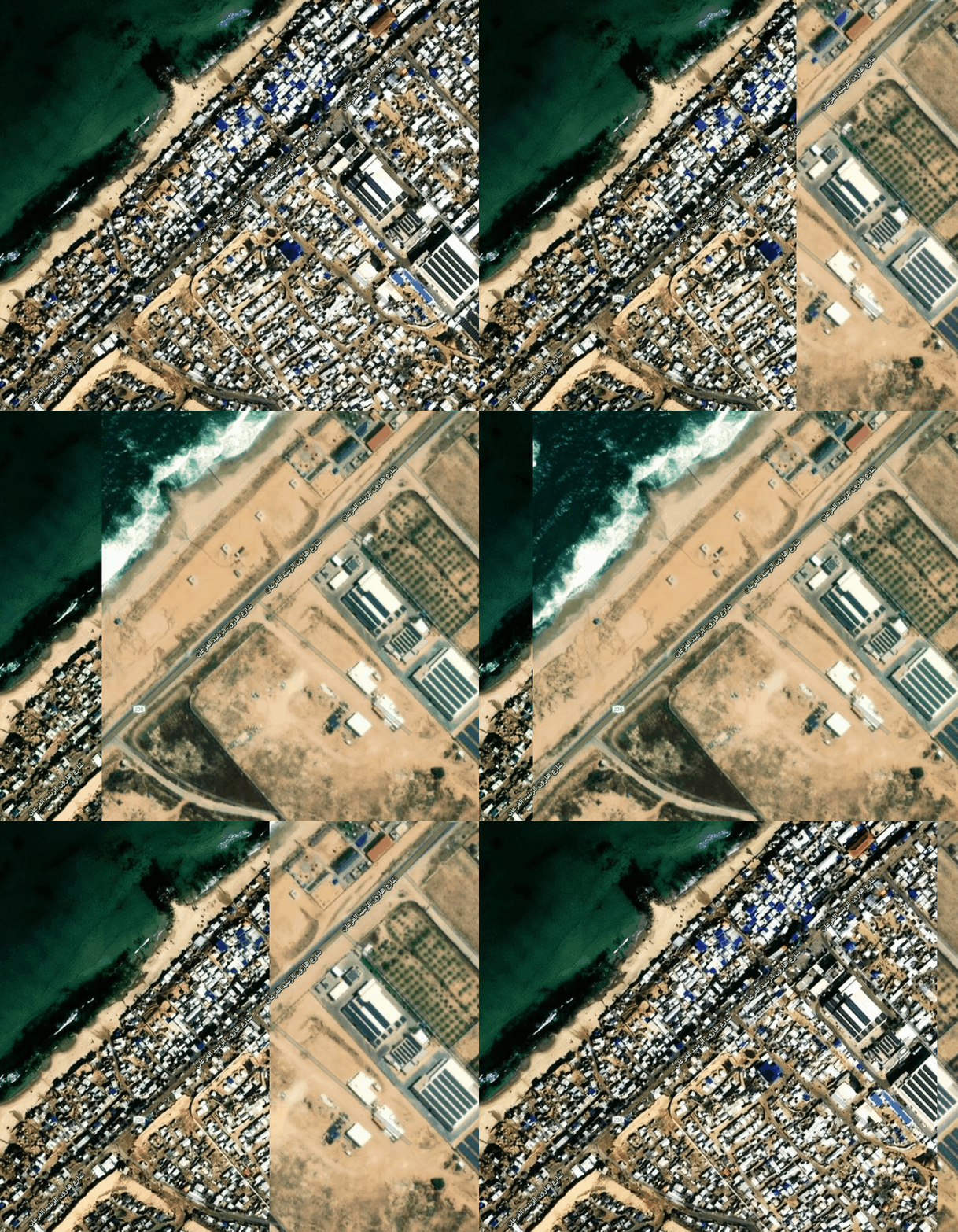
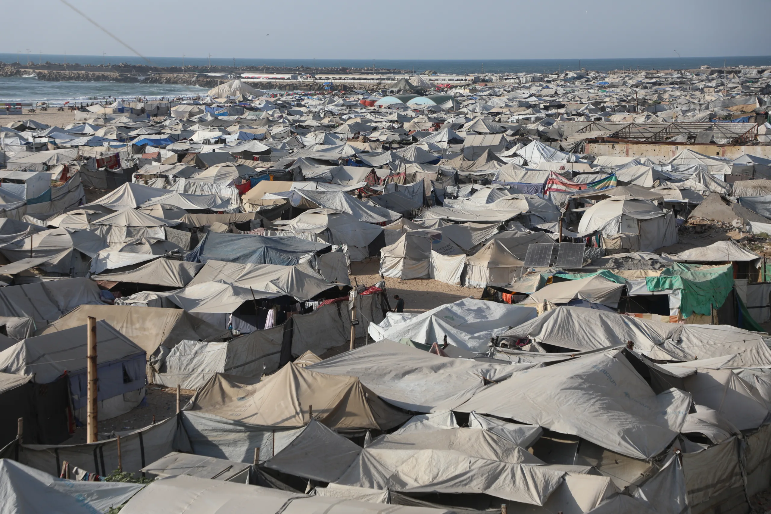
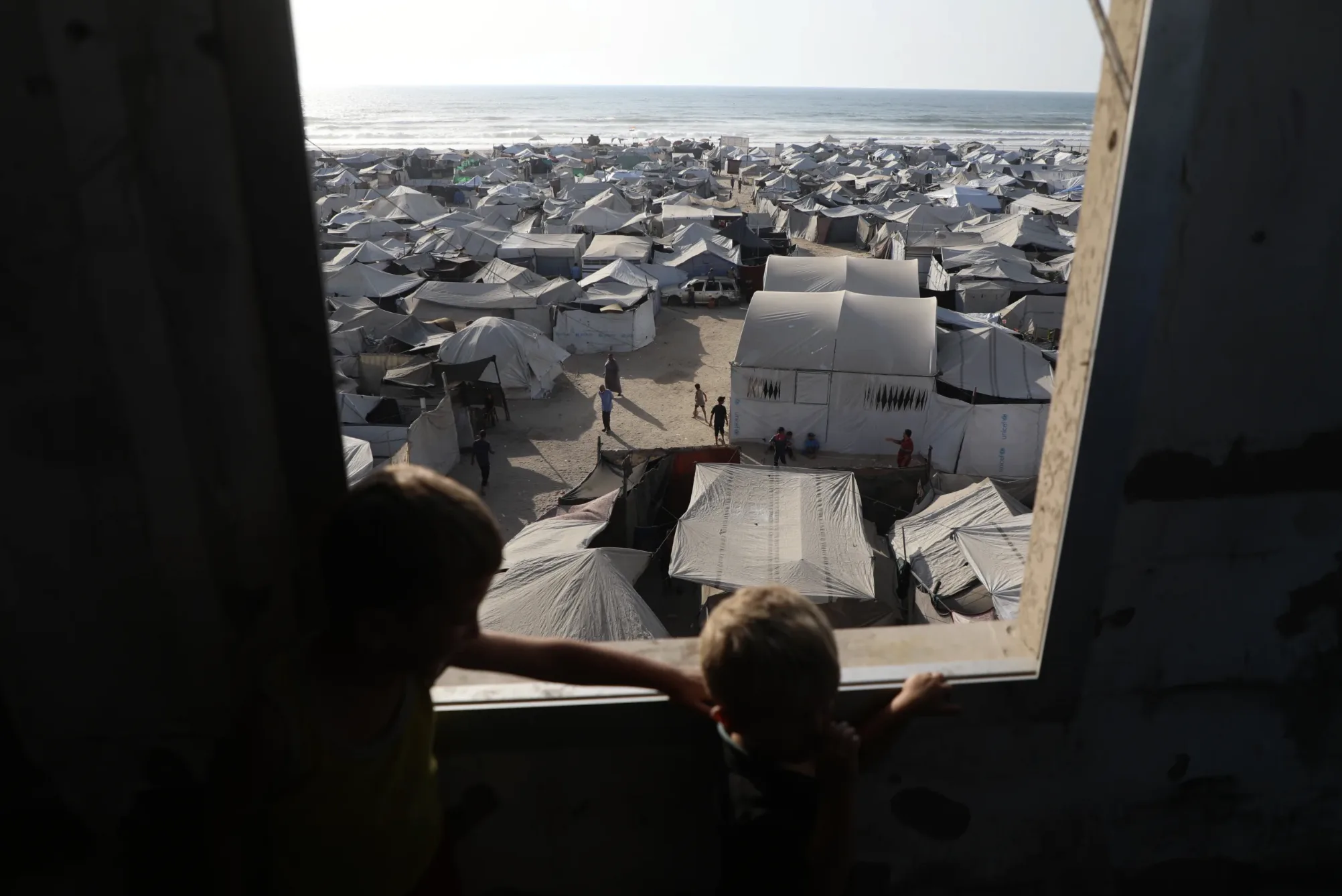
Satellite images reviewed by NoonPost show clusters of displaced people’s tents stretching to the seashore, where families have set up in shelters lacking water, sanitation, and protection from summer heat and winter cold.
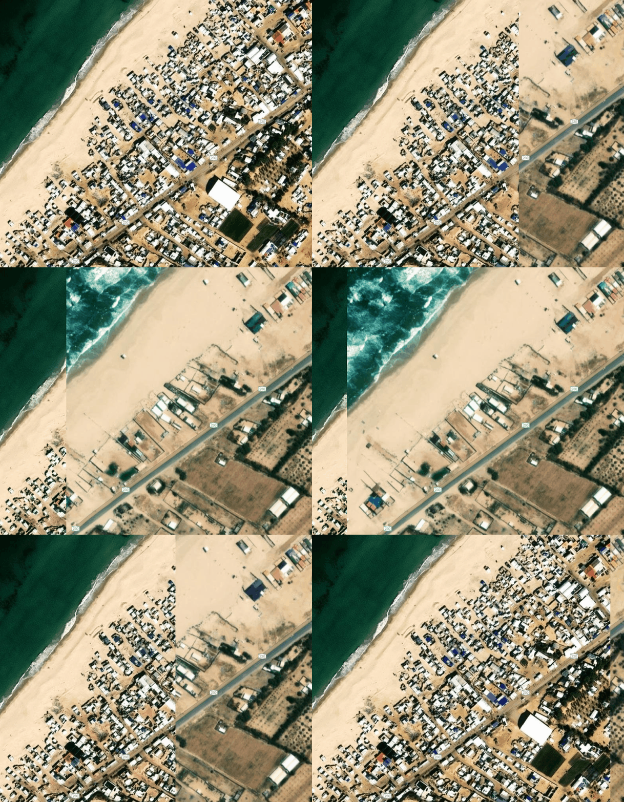
Exclusive testimonies collected by NoonPost confirm that reaching the coast came only after other places of displacement had been exhausted, as some displaced people were forced to move many times before ending up in tattered tents or unsafe structures, between the sea and the Israeli occupation army’s deployment zones.
The testimony of Shaaban Saeed Aliwa embodies what these images reveal. His family was displaced about 20 times, moving between schools, institutions, mosques, and relatives’ homes before reaching the coast. He says, “We found nowhere else to go, so we ended up on the beach, where we have been staying for about a year and a half, some of us in tents and some in ruined buildings unfit for human habitation.”
Aliwa is staying inside a destroyed Civil Defense building that the Israeli occupation army bombed, then the family cleaned and turned into a shelter despite parts of its roof having collapsed and the absence of water, bathrooms, and sewage networks. He says, “In winter, water surrounds us from above and below, and in summer we suffer from the heat and insects.”
He describes the place as closer to living on the street, amid rodents, garbage, and temperatures exceeding 104 degrees Fahrenheit. As the Israeli occupation’s lines of control advance, the area where they can seek refuge keeps shrinking. Aliwa says, “The closer the yellow line gets, the more pressure there is on us and the tighter the space becomes. We are trapped here without enough water, without food, and with nowhere else to move.”
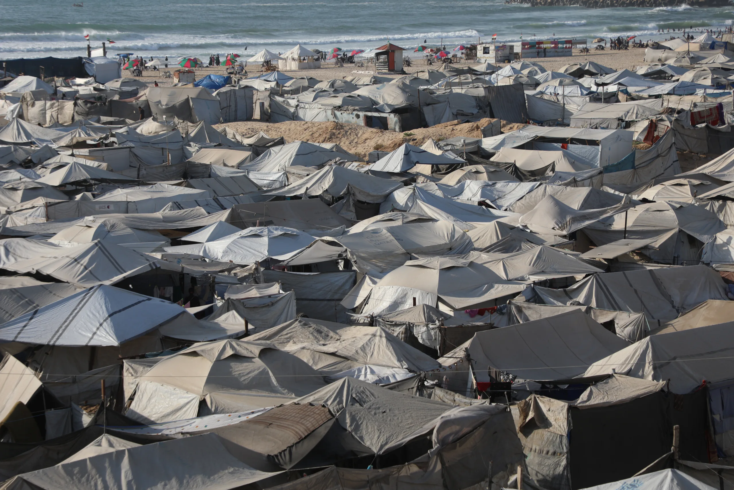
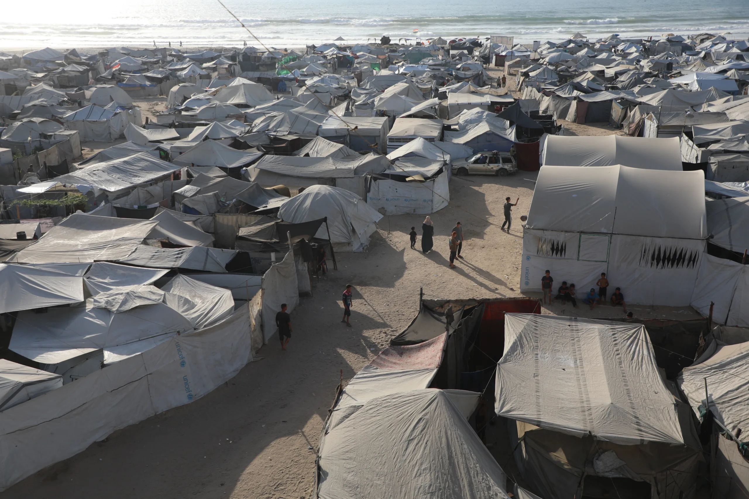
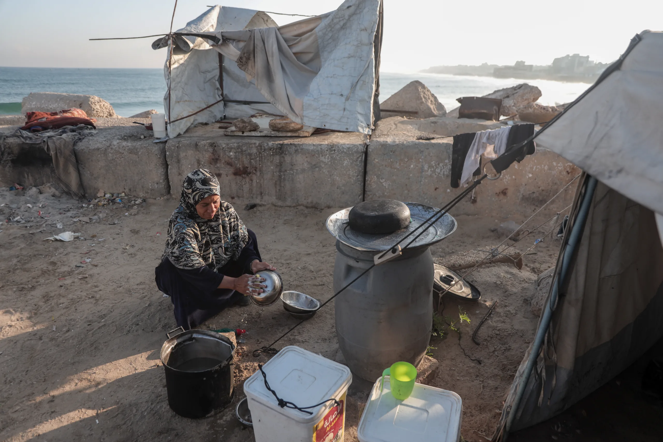
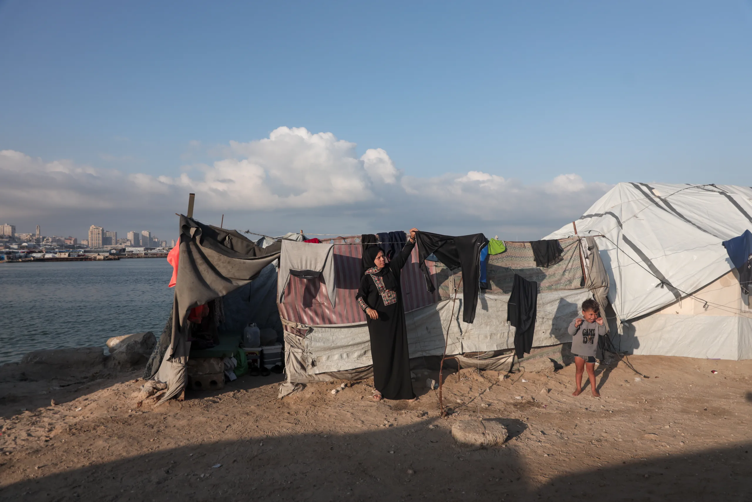
Photos and field footage documented by NoonPost’s correspondent in the Gaza Strip support what the satellite images showed and what displaced people described, showing tightly packed tents covering the narrow strip between the coastal roads and the beach, separated from the water by only a limited stretch of sand, directly exposed to the waves and wind.
Gaza Port: Tents fill the docks
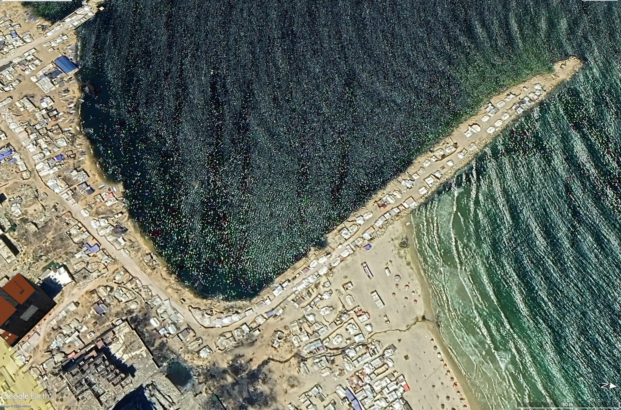
The belt of tents extends north to Gaza Port, where satellite images reviewed by NoonPost, and confirmed by field scenes documented by the site’s correspondent, reveal dense clusters of tents and shelters on the southern and eastern docks and on the road surrounding the basin, with only limited rock barriers separating some of them from the water.
There, the displaced face harsh conditions year-round: high heat and humidity in summer, and winds and rain that tear away tents and tarps in winter. Atef al-Farran told NoonPost that his family was forced to flee repeatedly before settling in the port area on the seashore. He says, “We were displaced 3, 4, or 5 times, and the last place we reached was the port area, where we are now staying on the beach.”
Al-Farran recalls what happened during the past winter, when several weather depressions hit the area and floodwaters inundated the tents and ruined their contents. He says, “Not a single tent stayed in place. We had to lay the tarps down on the ground, and we lost most of what we owned.”
Despite living alongside the sea, the family suffers from a severe shortage of usable water, receiving only limited quantities that are often salty. Al-Farran says they are waiting for the Israeli occupation army to withdraw so they can return to their area behind the “yellow line,” since they now have no option but to remain at this coastal site.
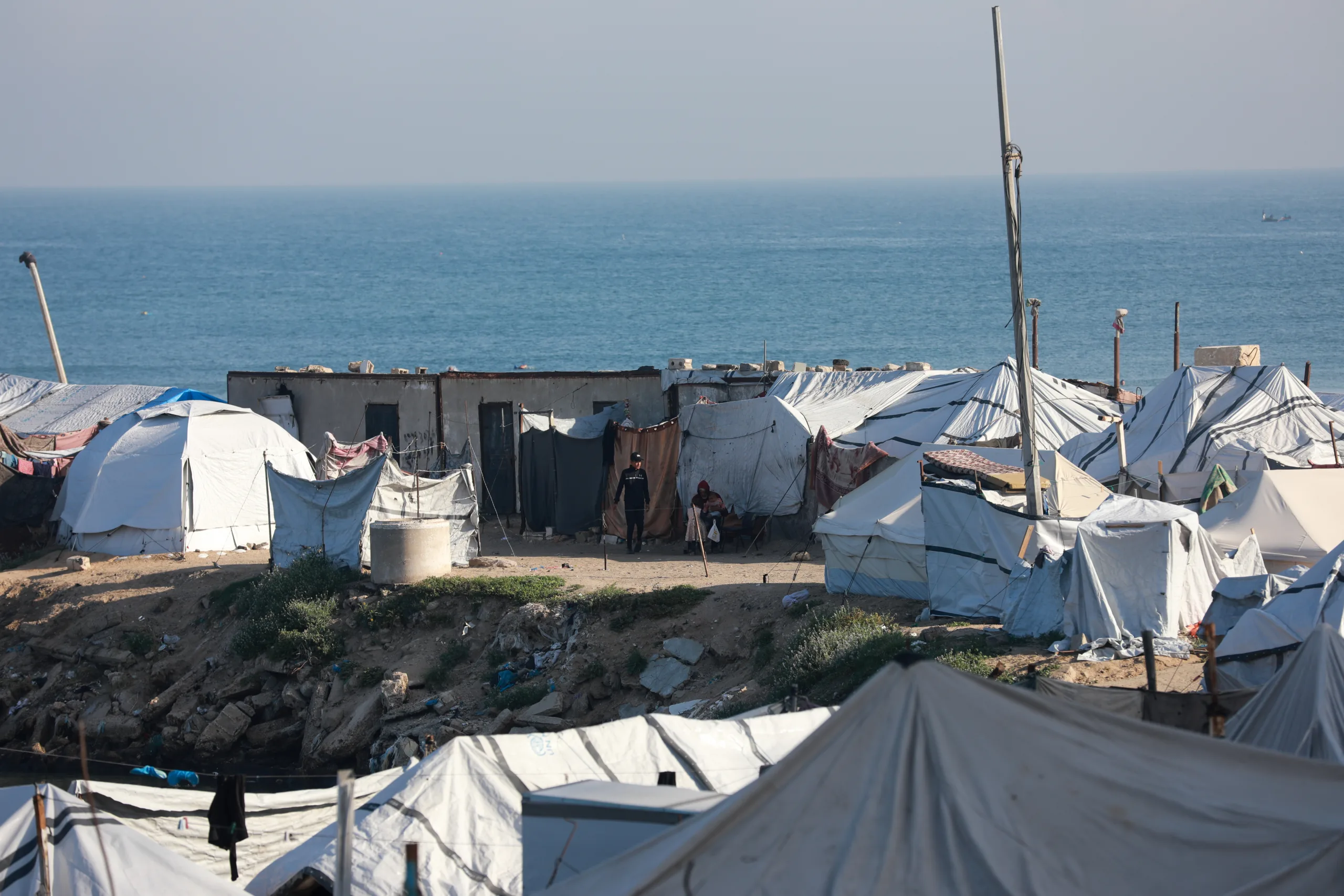
As in the previous testimonies, Salem Yacoub Ibrahim recounts how he was displaced from eastern al-Tuffah neighborhood to the port area west of Gaza City after a long journey of repeated displacement each time the Israeli occupation army advanced. On some days, he says, he was forced to flee with his children 3 or 4 times.
The journey ended with his family of eight inside a worn-out tent near the sea. He told NoonPost that “life next to the sea is extremely difficult because of the wind and the cold at night, while during the day the tent turns into a mass of fire that cannot be endured.” As a result, his children stay outside the tent for most of the day, returning only after the temperature drops in the afternoon.
The water crisis has reached the point that the family is forced to use seawater for its daily needs. Salem explains, “We go down to the sea and fill some containers until the water truck arrives, and we use its water to wash the children and clothes and for daily needs, despite its contamination with wastewater, because the fresh water that reaches us is not enough.”
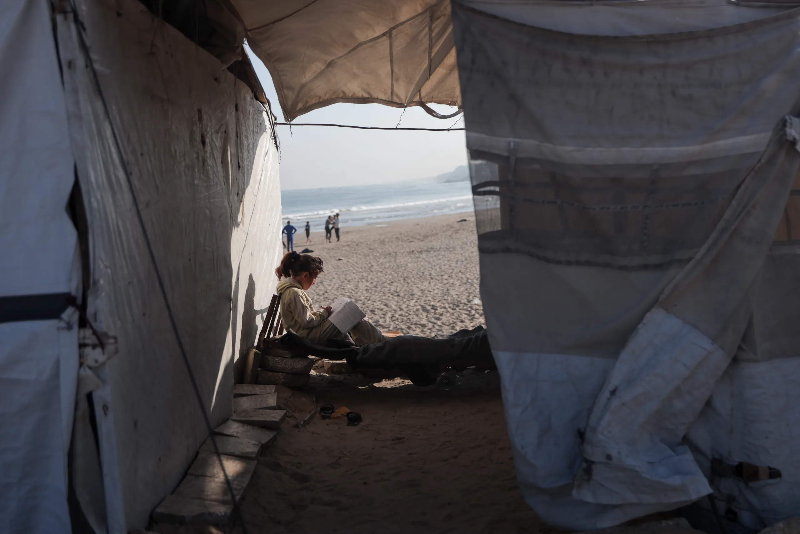
His health condition, along with one of his children’s heart disease, adds to the burdens of daily life and the difficulty of obtaining water and food. Salem believes the expansion of the “yellow line” has reduced the spaces available to the displaced and closed off the road back to their areas. He says, “The yellow line has taken over a wide area, and people no longer have room to move to other places. Returning to eastern al-Tuffah has also become extremely difficult.”
The dangers surrounding these families are not limited to sea waves and the possibility of flooding. Israeli airstrikes pursue them to the very last meters left to them for survival. On June 29, an airstrike killed a mother and her daughter in the area, destroyed the tents of more than 150 families, and damaged the tents of about 250 other families. Then an Israeli strike on July 12 hit a camp for displaced people in al-Mawasi, Khan Younis, killing one person and wounding others, including children.
After Gazans had grown used to looking at the sea as a temporary respite from the blockade or as the enclave’s natural geographic boundary, it has become the last place they know to settle. They have been pressed against its edge into a narrow margin of survival: behind them, the geography of annihilation expands, and within them is the fear of yet another displacement to a place that no longer exists in the first place.